

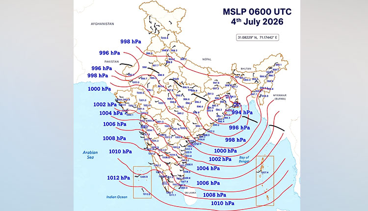
Bhubaneswar: The well-marked low-pressure system is accompanied by a seasonal trough positioned south of its normal location, according to the latest update from the India Meteorological Department (IMD).
Weather expert Umashankar Dash noted that the seasonal trough is positioned south of its normal location, while the tightly packed isobars indicate an impressive 18 hPa pressure gradient over the Bay of Bengal — a development described as an “absolute goosebumps moment” for weather enthusiasts.
This strong pressure gradient and the intensified system are expected to trigger widespread rainfall, thunderstorms, and gusty winds across several parts of Odisha and Chhattisgarh in the coming days.
The system is very likely to move west-northwestward across north Odisha and north Chhattisgarh during next 3 days.
The IMD had earlier reported the formation of a low-pressure area over the northwest Bay of Bengal and adjoining coasts. The system has now intensified into a well-marked low pressure area.
